 We climbed out of Angasmarca in the usually procession of ridges and valleys while the fiesta raged. The road was typical dusty dirt with little traffic and we crossed the largest log and sod bridge that I have seen to date.
 We climbed out of river valley and reached the small pueblo of Mollebamba is the late afternoon and decided to stop.
  The next day was a long 20km descent then a 5000 foot climb to another small pueblo of Pallesca. The roads were still quiet.
 On the descent we had a clear view of the steep switch back climb to come.
 The road had the usual sobering reminders of how dangerous they could be. Dylan was tired of pushing his single speed up the soft dusty switch backs and flagged down a local bus but said the bus ride was more harrowing than any ride could be.
 And despite taking a bus arrived less than an hour before me. I actually enjoyed the climb, feeling strong, and locals were enthusiastic in their greetings. The region receives no tourism and we heard stories of the last tourists on motorcycle. The previous year a couple from Germany passed through and she was "very beautiful." Next year someone will get to hear about the dirty cyclists. The next day was a long descent of nearly 3000 meters to the river valley below. Passing from high sierra to arid canyon that we would follow to the confluence of the Rio Santa . . . then climb again for thousands of meters.

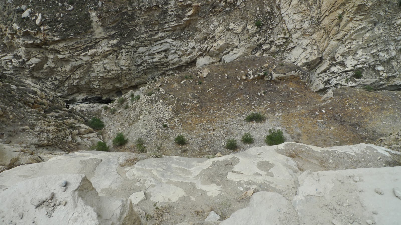
 While the canyon is dry the river provides water enabling agriculture. Besides an abundance of small gold mines the canyons are dotted with old stone terrace work dating back to the time of Inca and beyond. These river valleys have been major transportation routes into and out of the high sierra for thousands of years.
 The site above dates to nearly 4000 years ago.
 We reached the confluence with the Rio Santa in the middle of the afternoon and grab some food then start up the Rio Santa valley to camp.
 The day promised to be long up the river valley and through the Canon de Pato and we started early.

 Riding in the cool of the morning was beautiful way to start what would be a long day - 8hour ride time and 11 hours traveling. We passed through small communities that seemed to have larger populations in their graveyards.
 The sides of the valley rise 1000's of meters to both sides.
 Gold mines are replaced by small coal mines.
 As the canyon climbed and narrowed the road tunneled up the canyon - thankfully the traffic was very light with perhaps only 3 vehicles all morning.
 By the middle afternoon I reached the entrance to the Canon de Pato - Duck Canyon - but no ducks . . . unless you ordered one for lunch.
 The canyon is home to a hydroelectric project owned by Duke Energy. The road through the canyon was constructed in 1952 and features 35 tunnels in 35 kilometers! An average width of only 16 meters and canyon walls rising 1000's of meters.
  Sounds pretty cool but once you have seen one long dark tunnel you have seen them all . . . but you cannot see crap in tunnels.
 The tunnels are long, dark, dusty and a little terrifying on a bike. I strapped on my headlamp and plowed forward - entering the single lane tunnels pedaling like mad before a bus came. I was lucky enough to encounter only one combi in the tunnels - waving my headlamp frantically I clung to the side of the narrow tunnel. After passing I stood in a swirling cloud of powdery dust blinded to anything around me and hoping no more vehicles entered before I could choke my way the hell out of there. Some tunnels were dark enough to give you vertigo.
 Exiting the tunnel I would stop to take a breather and let the dust clear. But the canyon road is very narrow with no space between the edge of the road and canyon floor. The road had no railing but at times there were low concrete walls that would not actually stop a vehicle as much as launch it to the canyon floor below. . . Initially, I looked forward to this little engineering marvel but after 50 tunnels in a day I was done. As the canyon constricted to less than 6 meters I knew I was entering the blessed end.
 Exiting Canon de Pato a road construction worker reassured me that I would be riding on pavement in less than a kilometer. I was back in the high sierra again even higher than before. Riding into the evening, I caught a glimpse of the snow covered peaks of the Cordillera Blanca (2nd highest mountain range in the world). I rolled into the town of Caraz at dark - dusty and beat after four days of bone rattling riding through high sierra descending below 1000 meters then climbing back up to 3000 meters.

No comments:
Post a Comment